Sha'ar HaGai Khan
Beit Shemesh, IL
- Location
- Beit Shemesh, IL
- Category
- iconic bucket list
- Coordinates
- 31.814671, 35.023911
- Best time
- Morning or early afternoon
- Weather tip
- Check the local forecast before visiting.
Overview
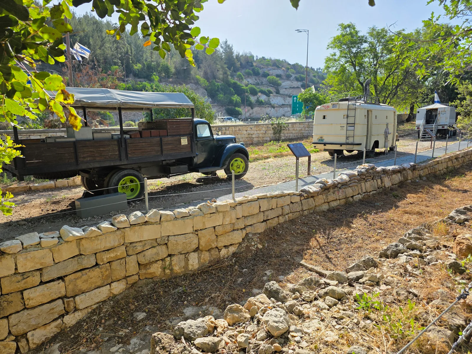
Sha'ar HaGai Khan, situated near the entrance to the Judean Hills, serves as a poignant historical site and a gateway to the road leading to Jerusalem. Historically known as Bab al-Wad, this location is synonymous with the arduous efforts to supply Jerusalem during the 1948 War of Independence. Today, the site has been transformed into a national heritage center that honors the courage of the convoy drivers and soldiers who fought to break the siege of the city. Visitors to this site can explore an immersive, evidence-based exhibition that chronicles the strategic importance of the route and the logistical challenges faced during the conflict. The facility provides a profound look at the human stories behind the armored vehicles that remain scattered along the roadside as silent witnesses to history. As you plan your itinerary, this site stands out among the essential places to visit in the region, offering a blend of education and reflection. The surrounding landscape, marked by steep cliffs and winding roads, provides a dramatic backdrop for understanding the terrain that defined the battles for the capital. For those seeking meaningful trip ideas, the Khan offers an essential perspective on the formative events of the State of Israel. Whether you are a history enthusiast or a traveler looking to understand the narrative of the region, the site provides a structured and deeply moving experience that connects the past to the present.
General information
Sha'ar HaGai Khan, situated near the entrance to the Judean Hills, serves as a poignant historical site and a gateway to the road leading to Jerusalem. Historically known as Bab al-Wad, this location is synonymous with the arduous efforts to supply Jerusalem during the 1948 War of Independence. Today, the site has been transformed into a national heritage center that honors the courage of the convoy drivers and soldiers who fought to break the siege of the city. Visitors to this site can explore an immersive, evidence-based exhibition that chronicles the strategic importance of the route and the logistical challenges faced during the conflict. The facility provides a profound look at the human stories behind the armored vehicles that remain scattered along the roadside as silent witnesses to history. As you plan your itinerary, this site stands out among the essential places to visit in the region, offering a blend of education and reflection. The surrounding landscape, marked by steep cliffs and winding roads, provides a dramatic backdrop for understanding the terrain that defined the battles for the capital. For those seeking meaningful trip ideas, the Khan offers an essential perspective on the formative events of the State of Israel. Whether you are a history enthusiast or a traveler looking to understand the narrative of the region, the site provides a structured and deeply moving experience that connects the past to the present.
Did you know
- The site is historically known as Bab al-Wad, which translates from Arabic to 'Gate of the Valley'.
- During the 1948 War of Independence, this narrow passage was the only road connecting the coastal plain to Jerusalem.
- The armored vehicles displayed at the site are preserved remnants of the convoys that attempted to break the siege.
History
Sha'ar HaGai (Bab al-Wad) gained strategic significance during the 1948 Arab-Israeli War. Because of its narrow, winding geography, the road was highly vulnerable to ambushes, making it the primary theater of the battle for the road to Jerusalem. Jewish convoys, often comprised of improvised armored trucks, faced constant fire from heights controlled by Arab irregulars. The struggle to keep this route open was essential to preventing the starvation and surrender of the Jewish population in Jerusalem. The area remains a symbol of the 'Breakthrough to Jerusalem' and the immense sacrifices made by the Palmach and other forces to secure the capital's supply lines.
Cultural significance
The site holds immense cultural and national significance as a memorial to the 'Convoy Drivers' and the soldiers of the Harel Brigade. It serves as a space for collective memory, emphasizing themes of resilience, sacrifice, and the existential struggle of the nascent state. The preservation of the site as a national heritage center ensures that the narrative of the 1948 siege is passed down to future generations, grounding the modern identity of the region in the historical reality of the War of Independence.
Geography and landscape
Sha'ar HaGai is located at the foot of the Judean Mountains, where the flat coastal plain meets the ascent toward the Jerusalem hills. The terrain is characterized by deep, narrow valleys and steep, rocky ridges. This topography created a natural 'choke point,' which historically dictated the movement of traffic and military forces. The landscape today is dominated by the modern highway that cuts through the dramatic limestone hills, juxtaposed with the rugged, preserved remnants of the original, more treacherous path that defined the region's military history.
More facts
- Imported from OSM batch
Visitor links
Nearby attractions
- Sha'ar HaGai lookout Beit Shemesh - 489 m
- Roman Mile Stones 1482 m
- משלט 21 Beit Shemesh - 1702 m
- Nebi Ayub Modi'in-Maccabim-Re'ut - 1855 m
- Bîr el Kŭsab Modi'in-Maccabim-Re'ut - 2301 m
- Jordanian Post Modi'in-Maccabim-Re'ut - 2301 m
- HaMasrek Nature Reserve Beit Shemesh - 2835 m
- Horvat Matzad 2877 m