Bayt Mahsir
Beit Shemesh, IL

- Location
- Beit Shemesh, IL
- Category
- heritage historic sites
- Coordinates
- 31.7939085, 35.0336254
- Best time
- Morning or early afternoon
- Weather tip
- Check the local forecast before visiting.
Overview
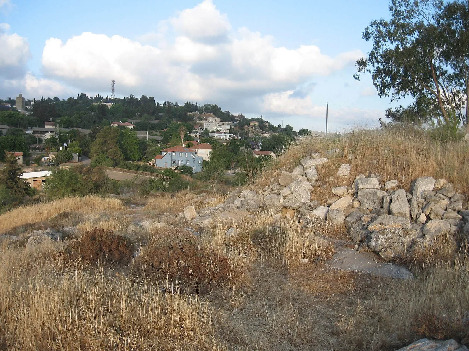
Bayt Mahsir, located in the vicinity of present-day Beit Shemesh, serves as a significant site for those interested in the historical landscape of the Judean foothills. Historically an Arab village, the site retains remnants of its past structure, offering a window into the rural architecture and settlement patterns that characterized the region prior to the mid-20th century. Visitors to the area often include this site as part of a broader exploration of the rural heritage of the Jerusalem corridor. When planning your trip ideas in this region, Bayt Mahsir offers a quiet, contemplative space that contrasts with the urban development of modern Beit Shemesh. The site is best explored during the morning or early afternoon when natural light provides the best visibility of the remaining stone foundations and terraces. As you navigate the site, you will encounter the physical remnants of agricultural life, including dry-stone walls and remnants of traditional dwellings. For those looking for historical attractions in the area, Bayt Mahsir provides a tangible link to the complex history of the Judean hills. It is recommended to check local weather forecasts before visiting, as the terrain is fully exposed to the elements. The site is ideal for those who appreciate off-the-beaten-path locations that offer historical context rather than modern amenities. Please note that as an archaeological and historical site, visitors are encouraged to respect the integrity of the ruins during their visit.
General information
Bayt Mahsir, located in the vicinity of present-day Beit Shemesh, serves as a significant site for those interested in the historical landscape of the Judean foothills. Historically an Arab village, the site retains remnants of its past structure, offering a window into the rural architecture and settlement patterns that characterized the region prior to the mid-20th century. Visitors to the area often include this site as part of a broader exploration of the rural heritage of the Jerusalem corridor. When planning your trip ideas in this region, Bayt Mahsir offers a quiet, contemplative space that contrasts with the urban development of modern Beit Shemesh. The site is best explored during the morning or early afternoon when natural light provides the best visibility of the remaining stone foundations and terraces. As you navigate the site, you will encounter the physical remnants of agricultural life, including dry-stone walls and remnants of traditional dwellings. For those looking for historical attractions in the area, Bayt Mahsir provides a tangible link to the complex history of the Judean hills. It is recommended to check local weather forecasts before visiting, as the terrain is fully exposed to the elements. The site is ideal for those who appreciate off-the-beaten-path locations that offer historical context rather than modern amenities. Please note that as an archaeological and historical site, visitors are encouraged to respect the integrity of the ruins during their visit.
Did you know
- The village of Bayt Mahsir was situated on a ridge overlooking the coastal plain and the Judean Mountains.
- The site is characterized by extensive agricultural terracing that remains visible today.
- The village was largely depopulated during the 1948 Arab-Israeli War.
History
Bayt Mahsir was a long-standing rural village in the Jerusalem district. Historical records indicate that the village was inhabited until 1948. The architecture of the village was typical of the Judean hills, primarily constructed from local limestone. Following the 1948 conflict, the site was abandoned. Today, the historical significance of the site lies in its preserved spatial layout and the remnants of its stone structures, which provide researchers and visitors with insights into the socio-economic life of the village during the late Ottoman and British Mandate periods.
Cultural significance
The site represents the traditional rural culture of the Judean foothills, reflecting a lifestyle deeply integrated with the agricultural cycles of the region. The preservation of the village foundations serves as an important cultural record of the demographic and structural changes that occurred in the area during the mid-20th century. It stands as a silent witness to the history of the Jerusalem corridor, inviting reflection on the layered past of the landscape that now surrounds the growing urban centers of the modern Beit Shemesh region.
Geography and landscape
Bayt Mahsir is situated within the rugged terrain of the Judean foothills. The landscape is defined by rolling hills, limestone outcrops, and extensive man-made terraces that were historically used for cultivating olives, grapes, and other crops. The elevation provides strategic views over the surrounding valleys, which was a common feature of village placement in this region. The area is characterized by Mediterranean scrubland and rocky outcrops, offering a stark, natural environment that remains largely undeveloped, preserving the original rural character of the site.
More facts
- Imported from OSM batch
Visitor links
Nearby attractions
- HaMasrek Nature Reserve Beit Shemesh - 718 m
- משלט 21 Beit Shemesh - 1014 m
- Mishlat 16 Beit Shemesh - 1252 m
- Anna Frank Memorial Beit Shemesh - 1803 m
- Nahal Kisalon Lookout Point Jerusalem District - 2070 m
- Sha'ar HaGai Khan Beit Shemesh - 2479 m
- Khirbet Midrag Beit Shemesh - 2503 m
- Sha'ar HaGai lookout Beit Shemesh - 2734 m