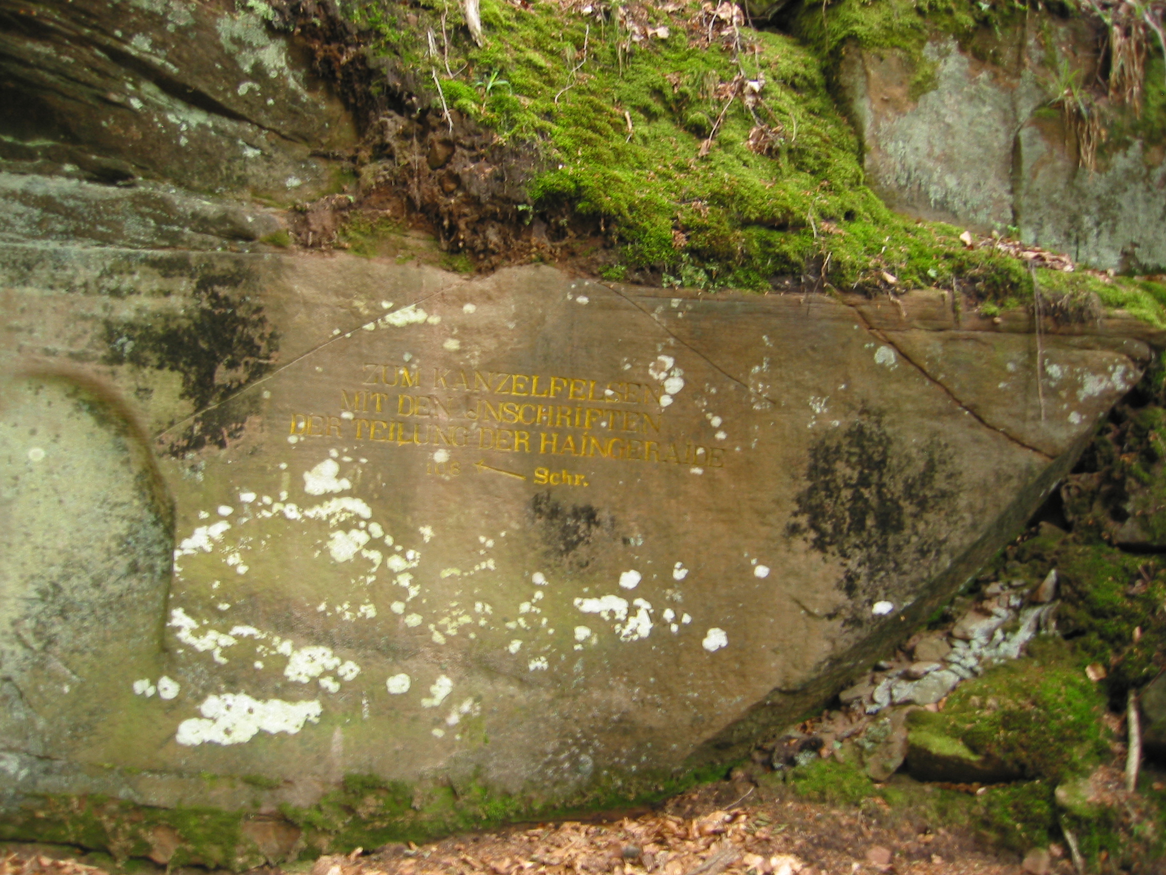
Ritterstein 90 "Zum Kanzelfelsen"
DE
- Location
- DE
- Category
- iconic bucket list
- Coordinates
- 49.3258535, 8.0194923
- Best time
- Morning or early afternoon
- Weather tip
- Check the local forecast before visiting.
Overview
Ritterstein 90, known as 'Zum Kanzelfelsen,' is a significant historical marker situated on the eastern slope of the Kanzelkopf mountain in the Palatinate Forest, Germany. These stone markers, known as 'Rittersteine,' are iconic historical relics that dot the landscape of the Pfälzerwald, serving as silent witnesses to the region's complex administrative and forestry history. Visitors seeking unique trip ideas in the Pfälzerwald will find this site particularly compelling for its blend of natural hiking and tangible history. The marker specifically serves as a navigational aid, directing hikers to the nearby Kanzelfelsen, which is located exactly 108 steps away. The Kanzelfelsen itself is notable for its historical inscriptions dating back to 1823, which document the formal division of a shared community forest between the villages of Maikammer, St. Martin, Diedesfeld, and Kirrweil. Exploring this site offers a glimpse into the socioeconomic structures of the 19th century, where land rights and forest usage were essential to the survival and prosperity of neighboring communities. For those planning what to do in the area, the path to Ritterstein 90 provides a rewarding trek through dense woodlands, offering a quiet, reflective experience away from major tourist hubs. It is recommended to visit during the morning or early afternoon to take advantage of the natural light filtering through the canopy, and travelers should always check the local weather forecast before embarking on forest trails.
General information
Ritterstein 90, known as 'Zum Kanzelfelsen,' is a significant historical marker situated on the eastern slope of the Kanzelkopf mountain in the Palatinate Forest, Germany. These stone markers, known as 'Rittersteine,' are iconic historical relics that dot the landscape of the Pfälzerwald, serving as silent witnesses to the region's complex administrative and forestry history. Visitors seeking unique trip ideas in the Pfälzerwald will find this site particularly compelling for its blend of natural hiking and tangible history. The marker specifically serves as a navigational aid, directing hikers to the nearby Kanzelfelsen, which is located exactly 108 steps away. The Kanzelfelsen itself is notable for its historical inscriptions dating back to 1823, which document the formal division of a shared community forest between the villages of Maikammer, St. Martin, Diedesfeld, and Kirrweil. Exploring this site offers a glimpse into the socioeconomic structures of the 19th century, where land rights and forest usage were essential to the survival and prosperity of neighboring communities. For those planning what to do in the area, the path to Ritterstein 90 provides a rewarding trek through dense woodlands, offering a quiet, reflective experience away from major tourist hubs. It is recommended to visit during the morning or early afternoon to take advantage of the natural light filtering through the canopy, and travelers should always check the local weather forecast before embarking on forest trails.
Did you know
- The 'Rittersteine' are a collection of over 300 sandstone markers in the Palatinate Forest, named after the Pfälzerwald-Verein's founder, Karl Ritter.
- The Kanzelfelsen inscriptions from 1823 represent a formal legal agreement regarding communal forest usage rights.
- The distance between Ritterstein 90 and the Kanzelfelsen is precisely measured at 108 steps.
History
Ritterstein 90 serves as a historical record of the territorial and communal management of the Palatinate Forest. In 1823, the villages of Maikammer, St. Martin, Diedesfeld, and Kirrweil reached a formal agreement regarding the division of a shared community forest. This agreement was not merely a verbal understanding but was physically memorialized through the inscriptions found on the nearby Kanzelfelsen. The Ritterstein itself was erected later to ensure that hikers and foresters could easily locate these historically significant boundary markers, preserving the memory of these complex land-rights negotiations that defined local life in the early 19th century.
Cultural significance
The site reflects the deeply rooted tradition of communal forest management in the Palatinate region. Historically, access to forest resources was a matter of economic survival for rural villages. The Kanzelfelsen inscriptions serve as a tangible link to the legal and social history of these four villages. Culturally, the preservation of the Rittersteine is a point of pride for the Pfälzerwald-Verein, which maintains these markers to educate the public about the region's heritage. The site acts as a monument to the cooperation and occasional conflict inherent in shared land ownership.
Geography and landscape
Ritterstein 90 is located on the eastern slope of the Kanzelkopf, a prominent elevation within the Palatinate Forest. The terrain is characterized by dense, mixed-deciduous and coniferous woodland typical of the Pfälzerwald. The area is rugged and hilly, requiring hikers to navigate established forest paths. The proximity to the Totenkopfstraße makes the site accessible for those exploring the wider region by foot. The landscape is defined by sandstone formations and forest floor vegetation, providing a quiet, temperate environment that is highly characteristic of the German low mountain ranges.
More facts
- Imported from OSM batch
Visitor links
Nearby attractions
- Ritterstein 91 "Zum Kanzelfelsen 120 Schr." 128 m
- Ritterstein 92 "Zum Röhringsbrunnen" 1091 m
- Ritterstein 86 "Schuhmacherstiefel" 1342 m
- Ritterstein 246 "Straßendamm" 2327 m
- Ritterstein 113 "R. Breitenstein 500 Schr." 2538 m
- Ritterstein 65 "Schanze IV" 2929 m
- Ritterstein 238 "Lolosruhe Fünf Steine" 2937 m
- Ritterstein 62 "Hauptschanze I" 3075 m