Ritterstein 246 "Straßendamm"
DE
- Location
- DE
- Category
- iconic bucket list
- Coordinates
- 49.3213674, 8.0507527
- Best time
- Morning or early afternoon
- Weather tip
- Check the local forecast before visiting.
Overview
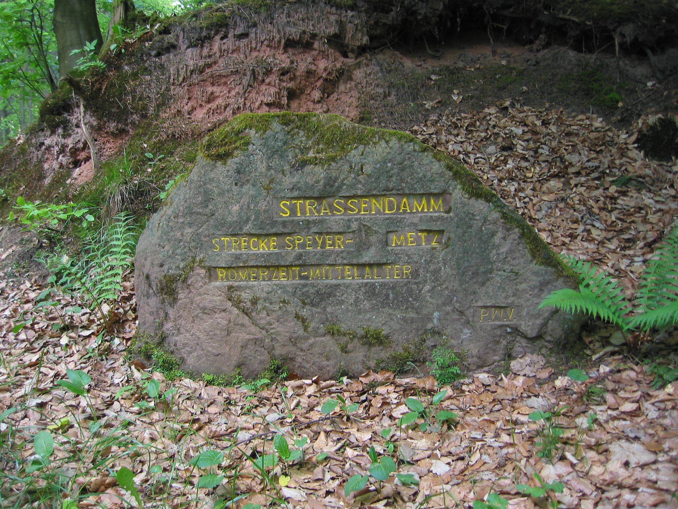
Ritterstein 246, known as "Straßendamm," is a significant historical marker located in the Palatinate Forest (Pfälzerwald), Germany. Situated directly opposite the Totenkopfhütte, a popular mountain hut maintained by the Pfälzerwald-Verein, this stone serves as a tangible link to the region's ancient infrastructure. The primary draw for visitors is the remarkably well-preserved embankment of a former Roman road, which remains visible in the immediate vicinity of the marker. For those interested in historical hiking, these markers are essential landmarks that provide context to the dense forest trails. Exploring the Rittersteine is a classic activity for history enthusiasts seeking unique trip ideas in the Palatinate region. Visitors can expect a tranquil outdoor experience, as the stone is nestled within the lush, forested landscape of the Pfälzerwald. While the site itself is a compact historical feature, it serves as an excellent waypoint for longer trekking routes through the surrounding woodland. It is recommended to visit during the morning or early afternoon to take advantage of natural light when examining the Roman road embankment. As this is an outdoor site, checking the local weather forecast is advised to ensure a pleasant excursion. Whether you are a local hiker or a tourist mapping out places to visit, the Straßendamm offers a quiet, educational glimpse into the Roman occupation of the Germania Superior province.
General information
Ritterstein 246, known as "Straßendamm," is a significant historical marker located in the Palatinate Forest (Pfälzerwald), Germany. Situated directly opposite the Totenkopfhütte, a popular mountain hut maintained by the Pfälzerwald-Verein, this stone serves as a tangible link to the region's ancient infrastructure. The primary draw for visitors is the remarkably well-preserved embankment of a former Roman road, which remains visible in the immediate vicinity of the marker. For those interested in historical hiking, these markers are essential landmarks that provide context to the dense forest trails. Exploring the Rittersteine is a classic activity for history enthusiasts seeking unique trip ideas in the Palatinate region. Visitors can expect a tranquil outdoor experience, as the stone is nestled within the lush, forested landscape of the Pfälzerwald. While the site itself is a compact historical feature, it serves as an excellent waypoint for longer trekking routes through the surrounding woodland. It is recommended to visit during the morning or early afternoon to take advantage of natural light when examining the Roman road embankment. As this is an outdoor site, checking the local weather forecast is advised to ensure a pleasant excursion. Whether you are a local hiker or a tourist mapping out places to visit, the Straßendamm offers a quiet, educational glimpse into the Roman occupation of the Germania Superior province.
Did you know
- Rittersteine are sandstone blocks inscribed by the Pfälzerwald-Verein to mark historical sites.
- The term 'Straßendamm' translates to 'Road Embankment,' referring to the Roman construction technique.
- The Totenkopfhütte, located right across from the stone, is a well-known stop for hikers in the Palatinate Forest.
History
The Ritterstein 246 commemorates the existence of a Roman road that once traversed this part of the Pfälzerwald. During the Roman occupation of the region, specifically within the province of Germania Superior, road networks were vital for military logistics and trade. The "Straßendamm" (road embankment) is a physical remnant of these engineering efforts, characterized by raised earthworks designed to stabilize the roadbed across uneven forest terrain. The Pfälzerwald-Verein installed the Ritterstein to ensure that this historical feature remained identified and preserved for future generations of hikers and researchers interested in the Roman legacy of the Rhineland-Palatinate area.
Cultural significance
The Rittersteine collectively represent a unique cultural heritage project in the Palatinate region. Initiated by the Pfälzerwald-Verein in the early 20th century, the project aimed to document and highlight historical, geological, and botanical sites throughout the forest. Ritterstein 246 is part of this network of over 300 stones, which transforms the forest into an open-air museum. It reflects the German cultural tradition of 'Heimatkunde' (local history and geography), emphasizing the importance of preserving local narratives and physical heritage within the natural landscape, allowing the public to engage directly with the history of their immediate environment.
Geography and landscape
The site is located within the Pfälzerwald, the largest contiguous forest area in Germany. The landscape is characterized by rugged sandstone formations, dense mixed woodlands, and rolling hills. The specific location of Ritterstein 246 is adjacent to a forest road near the Totenkopfhütte. The terrain here is typical of the Palatinate Forest, featuring sandy soils and a canopy that provides shade for the historical embankment. The elevation and orientation of the site make it a cool, shaded environment, ideal for hiking, though the path can be uneven due to the natural forest floor and the presence of the ancient, raised Roman road structure.
More facts
- Imported from OSM batch
Visitor links
Nearby attractions
- Ritterstein 239 "Huettenhohl Ruine Alte Huette" 1114 m
- Ritterstein 91 "Zum Kanzelfelsen 120 Schr." 2270 m
- Ritterstein 90 "Zum Kanzelfelsen" 2327 m
- Ritterstein 243 "Wetz-Brunnen" 2469 m
- Ritterstein 238 "Lolosruhe Fünf Steine" 2520 m
- Ritterstein 86 "Schuhmacherstiefel" 2746 m
- Ritterstein 65 "Schanze IV" 3213 m
- Ritterstein 68 "General v. Pfau" 3273 m