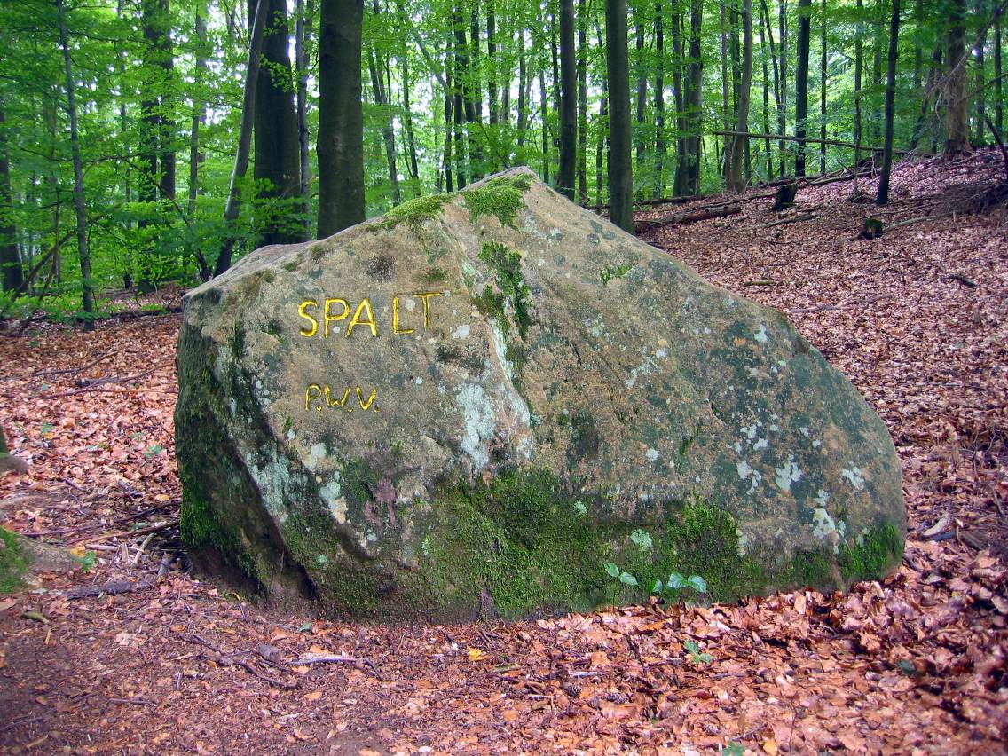
Ritterstein 55 "Spalt"
DE
- Location
- DE
- Category
- iconic bucket list
- Coordinates
- 49.2433394, 7.7923437
- Best time
- Morning or early afternoon
- Weather tip
- Check the local forecast before visiting.
Overview
Ritterstein 55, known locally as 'Spalt', is a significant historical marker located in the Palatinate Forest (Pfälzerwald) of Germany. Situated precisely within the saddle between the Wartenberg and the Schmaler Hals mountains, this site is marked by a characteristic sandstone monument. The name 'Spalt'—meaning 'cleft' or 'fissure'—derives from the narrow, gorge-like formation created by the geological positioning of these two peaks. For hikers and history enthusiasts, exploring these markers offers a unique glimpse into the regional heritage of the Palatinate. Visitors often include this site as part of their broader trip ideas when traversing the extensive network of trails in the region. As you navigate the forest, you will find that Ritterstein 55 serves as both a geographical waypoint and a testament to the local naming traditions that have defined these woodlands for centuries. Whether you are looking for new places to visit or simply enjoying a trek through the dense canopy, the area surrounding the Wartenberg provides a serene environment for outdoor exploration. It is recommended to visit during the morning or early afternoon to take advantage of the natural light filtering through the trees. Always ensure you check the local weather forecast before embarking on your hike, as conditions in the mountainous terrain can shift rapidly.
General information
Ritterstein 55, known locally as 'Spalt', is a significant historical marker located in the Palatinate Forest (Pfälzerwald) of Germany. Situated precisely within the saddle between the Wartenberg and the Schmaler Hals mountains, this site is marked by a characteristic sandstone monument. The name 'Spalt'—meaning 'cleft' or 'fissure'—derives from the narrow, gorge-like formation created by the geological positioning of these two peaks. For hikers and history enthusiasts, exploring these markers offers a unique glimpse into the regional heritage of the Palatinate. Visitors often include this site as part of their broader trip ideas when traversing the extensive network of trails in the region. As you navigate the forest, you will find that Ritterstein 55 serves as both a geographical waypoint and a testament to the local naming traditions that have defined these woodlands for centuries. Whether you are looking for new places to visit or simply enjoying a trek through the dense canopy, the area surrounding the Wartenberg provides a serene environment for outdoor exploration. It is recommended to visit during the morning or early afternoon to take advantage of the natural light filtering through the trees. Always ensure you check the local weather forecast before embarking on your hike, as conditions in the mountainous terrain can shift rapidly.
Did you know
- Rittersteine are sandstone monuments in the Palatinate Forest that mark historical, geographical, or cultural points of interest.
- The term 'Spalt' refers to the narrow, gorge-like saddle between the Wartenberg and Schmaler Hals peaks.
- There are over 300 Rittersteine scattered throughout the Palatinate Forest, each with its own unique number and designation.
History
Rittersteine were established primarily by the Pfälzerwald-Verein (Palatinate Forest Association) starting in the late 19th century. These markers were intended to preserve local history, document geographical features, and honor regional personalities or events. Ritterstein 55 serves as a permanent record of the popular nomenclature used by local inhabitants to describe the distinct geological landscape found between the Wartenberg and Schmaler Hals mountains. By carving these names into durable sandstone, the association ensured that traditional names for forest locations were not lost to time.
Cultural significance
The Rittersteine are culturally significant as tangible manifestations of local folklore and regional identity in the Palatinate. They represent a historical effort to categorize and label the wilderness, transforming an anonymous forest into a landscape filled with named features and stories. For the local community, these stones are not merely trail markers but are symbols of a deep-rooted connection to the land. They reflect the cultural practice of 'toponymy,' where the physical characteristics of the terrain, such as the 'Spalt' or cleft, are woven into the shared vernacular of the people who traverse these woods.
Geography and landscape
The site is located within the Palatinate Forest, a large, densely wooded area characterized by its rugged sandstone formations and rolling hills. Ritterstein 55 is positioned specifically in a saddle—a low point between two higher elevations—which creates a natural corridor between the Wartenberg and the Schmaler Hals mountains. The terrain here is typical of the region, featuring mixed deciduous and coniferous forests. The 'Spalt' itself is a narrow, ravine-like depression that highlights the erosive history of the sandstone landscape, offering a cool, shaded microclimate that is distinct from the surrounding ridges.
More facts
- Imported from OSM batch
Visitor links
Nearby attractions
- Ritterstein 56 "Königswoog" 1101 m
- Ritterstein 50 "Wildsauhütte" 1707 m
- Ritterstein 40 "R. Granitzenhütte" 2393 m
- Ritterstein 54 Schäferei 2469 m
- Ritterstein 231 "An der Karlsmühle" 2629 m
- Ritterstein 60 "R. Jagdhaeuschen" 2749 m
- Ritterstein 232 "Gambsklause 1841" 2909 m
- Ritterstein 52 "Eusserthaler Klostergut" 3232 m