Plikasis (Kreivasis) kalnas
Vilnius, IL
- Location
- Vilnius, IL
- Category
- viewpoints natural phenomena
- Coordinates
- 54.6870585, 25.2975189
- Best time
- Morning or early afternoon
- Weather tip
- Check the local forecast before visiting.
Overview
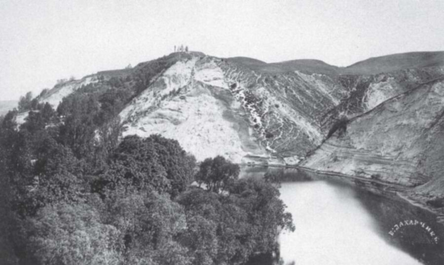
Plikasis kalnas, also known as Kreivasis kalnas (the Crooked Hill), is a significant archaeological site located within the Kalnų Park area of Vilnius. As a hillfort featuring auxiliary earthworks—or 'papiliai'—this site serves as a vital link to the historical defense systems of the Grand Duchy of Lithuania. Visitors arriving at this elevated vantage point are greeted with panoramic views of the Vilnius Old Town, the winding Neris River, and the surrounding forested valleys. It is considered one of the essential places to visit for those interested in the early medieval urban development of the city. The site offers a tranquil escape from the bustling city center, providing a unique opportunity to stand upon the same ground where ancient wooden fortifications once stood. When planning your trip, consider that the area is best explored during the morning or early afternoon to take full advantage of the natural light for photography and observation. As you explore the terrain, you will find that it functions both as a historical monument and a serene natural park, making it one of the most rewarding local attractions for history enthusiasts and hikers alike. The site remains an open-access area, allowing guests to traverse the ancient paths and contemplate the strategic importance of this high ground in the context of medieval territorial defense.
General information
Plikasis kalnas, also known as Kreivasis kalnas (the Crooked Hill), is a significant archaeological site located within the Kalnų Park area of Vilnius. As a hillfort featuring auxiliary earthworks—or 'papiliai'—this site serves as a vital link to the historical defense systems of the Grand Duchy of Lithuania. Visitors arriving at this elevated vantage point are greeted with panoramic views of the Vilnius Old Town, the winding Neris River, and the surrounding forested valleys. It is considered one of the essential places to visit for those interested in the early medieval urban development of the city. The site offers a tranquil escape from the bustling city center, providing a unique opportunity to stand upon the same ground where ancient wooden fortifications once stood. When planning your trip, consider that the area is best explored during the morning or early afternoon to take full advantage of the natural light for photography and observation. As you explore the terrain, you will find that it functions both as a historical monument and a serene natural park, making it one of the most rewarding local attractions for history enthusiasts and hikers alike. The site remains an open-access area, allowing guests to traverse the ancient paths and contemplate the strategic importance of this high ground in the context of medieval territorial defense.
Did you know
- The hill is historically associated with the 'Crooked Castle' (Kreivoji pilis) mentioned in 14th-century chronicles.
- The site features distinct 'papiliai,' which are secondary defensive earthworks used to protect the main hillfort.
- It provides one of the most unobstructed views of the Gediminas Tower and the confluence of the Vilnia and Neris rivers.
History
Plikasis kalnas is deeply intertwined with the medieval history of Vilnius. During the 14th century, the site was part of a complex defensive network that protected the city from the Teutonic Order. Historical records, particularly those from the Teutonic chronicles, refer to a 'Crooked Castle' located on this ridge, which was destroyed in 1390. Archaeological investigations have identified cultural layers that confirm human activity from the early medieval period. The hill's strategic height made it an ideal location for observation and defense, and the presence of 'papiliai' suggests a sophisticated approach to fortification design that utilized the natural topography of the glacial landscape to deter potential invaders.
Cultural significance
Culturally, the hill serves as a symbol of Lithuanian resilience and the early statehood of the Grand Duchy. It is a protected archaeological monument that helps define the historical identity of Vilnius. Beyond its military past, the hill is ingrained in the collective memory of the city's residents as a place of reflection and connection to the landscape. It is frequently visited during national holidays and commemorations, acting as a silent witness to the evolution of the city from a pagan stronghold to a modern European capital. The hill is a protected heritage site, preserved to maintain the integrity of Vilnius's ancient defensive perimeter.
Geography and landscape
The site is situated within the hilly topography of the Vilnius region, characterized by deep glacial valleys and steep slopes. Plikasis kalnas rises prominently above the surrounding landscape, providing a natural vantage point over the confluence of the Vilnia and Neris rivers. The terrain is largely covered by mature trees and grasslands, which have partially obscured the original man-made earthworks over the centuries. The park area surrounding the hill is defined by uneven, undulating ground, requiring visitors to navigate varied elevations. The geological composition is primarily glacial till, typical of the East Lithuanian Uplands, which has been shaped by both natural erosion and centuries of human construction.
More facts
- Imported from OSM Overpass
Visitor links
Nearby attractions
- Stalo kalnas Vilnius - 245 m
- Gedimino kalnas Vilnius - 392 m
- Old Arsenal Vilnius - 413 m
- Gedimino kapo kalnas Vilnius - 433 m
- Altanos kalnas Vilnius - 434 m
- New Arsenal Vilnius - 542 m
- The National Museum – Palace of the Grand Dukes of Lithuania Vilnius - 568 m
- Church Heritage Museum in Vilnius Vilnius - 586 m