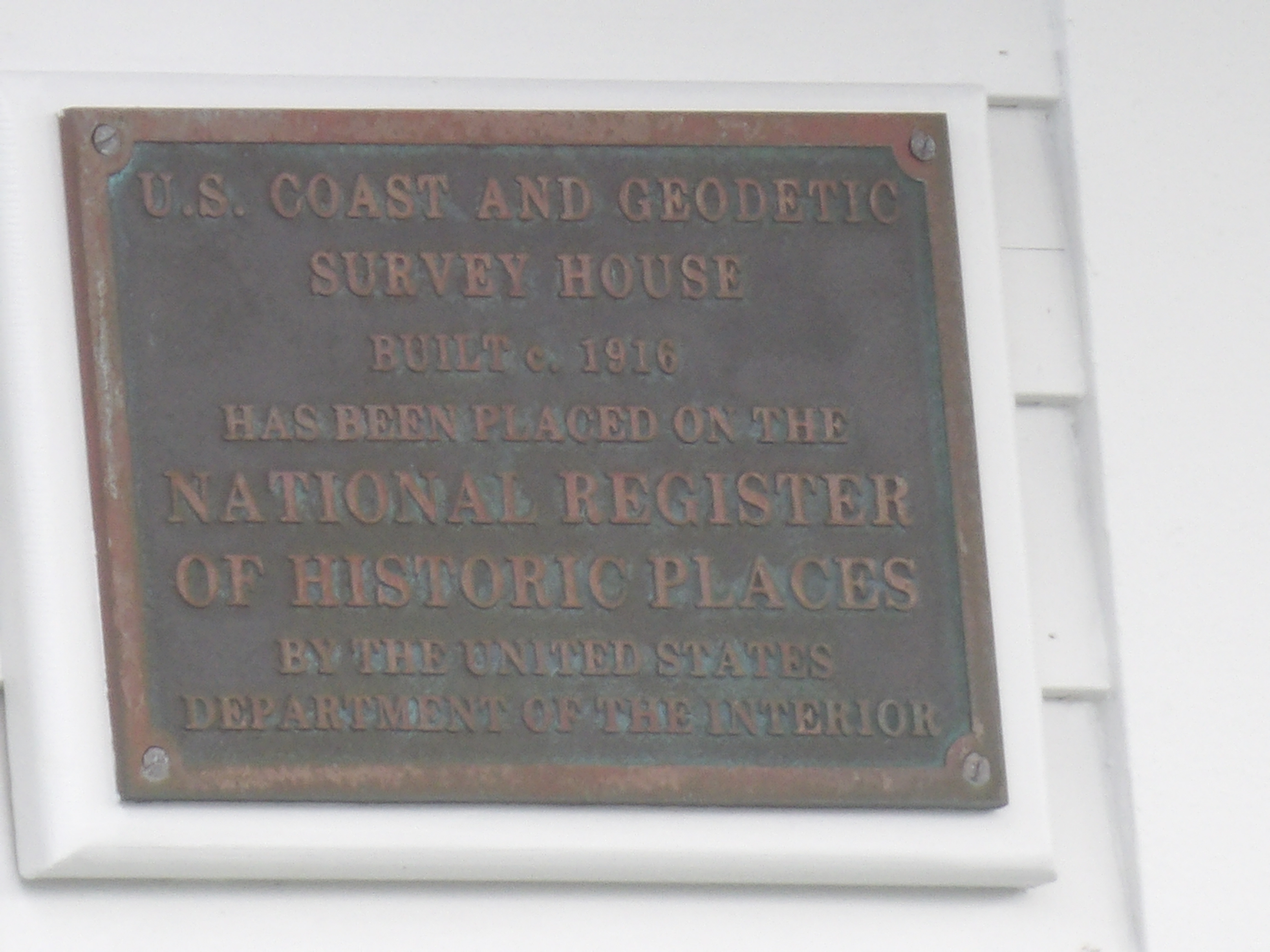
U.S. Coast and Geodetic Survey House
Sitka, US
- Location
- Sitka, US
- Category
- heritage historic sites
- Coordinates
- 57.0505728, -135.3361542
- Best time
- Morning or early afternoon
- Weather tip
- Check the local forecast before visiting.
Overview
The U.S. Coast and Geodetic Survey House in Sitka, Alaska, stands as a testament to the scientific rigor required to map the vast, rugged coastline of the newly acquired territory in the late 19th century. Following the 1867 purchase of Alaska from Russia, the United States faced the immediate challenge of charting treacherous waters and establishing a physical presence in the region. This historic structure served as a vital base of operations for the personnel tasked with conducting hydrographic and topographic surveys essential for maritime safety and territorial governance. Today, visitors to Sitka interested in maritime history and the evolution of American cartography will find this site a compelling stop. It offers a unique glimpse into the logistical efforts that bridged the gap between scientific exploration and the integration of Alaska into the United States. When considering what to do in the area, a visit to this site provides an excellent educational perspective on the scientific foundations of the Pacific Northwest. As travelers explore local attractions, the Survey House remains a quiet but significant anchor for understanding the transition of Sitka from a colonial outpost to a strategic American port. The site is best experienced during the morning or early afternoon, allowing for optimal light to appreciate its architectural character and historical context within the broader landscape of Sitka’s preserved heritage.
General information
The U.S. Coast and Geodetic Survey House in Sitka, Alaska, stands as a testament to the scientific rigor required to map the vast, rugged coastline of the newly acquired territory in the late 19th century. Following the 1867 purchase of Alaska from Russia, the United States faced the immediate challenge of charting treacherous waters and establishing a physical presence in the region. This historic structure served as a vital base of operations for the personnel tasked with conducting hydrographic and topographic surveys essential for maritime safety and territorial governance. Today, visitors to Sitka interested in maritime history and the evolution of American cartography will find this site a compelling stop. It offers a unique glimpse into the logistical efforts that bridged the gap between scientific exploration and the integration of Alaska into the United States. When considering what to do in the area, a visit to this site provides an excellent educational perspective on the scientific foundations of the Pacific Northwest. As travelers explore local attractions, the Survey House remains a quiet but significant anchor for understanding the transition of Sitka from a colonial outpost to a strategic American port. The site is best experienced during the morning or early afternoon, allowing for optimal light to appreciate its architectural character and historical context within the broader landscape of Sitka’s preserved heritage.
Did you know
- The U.S. Coast and Geodetic Survey is the oldest scientific agency in the United States, originally established by Thomas Jefferson in 1807.
- The house was integral to the 'Alaska Survey,' a massive undertaking to chart thousands of miles of coastline that were previously poorly mapped.
- The structure reflects the utilitarian architectural style typical of federal buildings constructed in Alaska during the late 1800s.
History
Following the Alaska Purchase of 1867, the U.S. government prioritized the mapping of Alaskan waters to facilitate trade and ensure the safety of naval and commercial vessels. The Coast and Geodetic Survey House was established as a headquarters for the surveyors who arrived in Sitka to conduct these critical operations. These surveyors utilized advanced instruments of the era to determine precise coordinates, sound depths, and document coastal features. The building served as both a workspace for processing data and a residence for the personnel, marking a period of intense scientific activity that transformed Sitka into a hub for American maritime logistics in the North Pacific.
Cultural significance
The Survey House represents the intersection of scientific exploration and national expansion. Its existence highlights the cultural shift in Sitka as it transitioned from Russian rule to becoming a focal point of American scientific interest. The site is recognized for its role in the long-term project of documenting the Alaskan frontier, which helped define the boundaries and maritime pathways of the state. It serves as a physical reminder of the surveyors whose work allowed for the integration of Alaska into the national economy and provided the foundational data for modern Alaskan navigation.
Geography and landscape
Located in the historic district of Sitka, the Survey House is situated within a landscape defined by the dramatic meeting of the North Pacific Ocean and the volcanic terrain of Baranof Island. The surrounding area is characterized by dense temperate rainforests, rugged shorelines, and the looming presence of Mount Verstovia. The urban context of Sitka reflects its history as a colonial port, with the Survey House positioned to overlook the harbor waters it was designed to map. The terrain is largely coastal, with the building’s orientation providing a strategic view of the maritime environment that remains central to the town's geography.
More facts
- Imported from OSM batch
Visitor links
Nearby attractions
- Russian Bishop's House Sitka - 459 m
- Sitka National Cemetery Sitka - 1225 m
- Sitka National Historical Park Sitka - 1410 m
- Old Sitka Sitka - 9246 m