Ritterstein 248 "Speyerheld"
DE
- Location
- DE
- Category
- iconic bucket list
- Coordinates
- 49.3383944, 8.1118069
- Best time
- Morning or early afternoon
- Weather tip
- Check the local forecast before visiting.
Overview
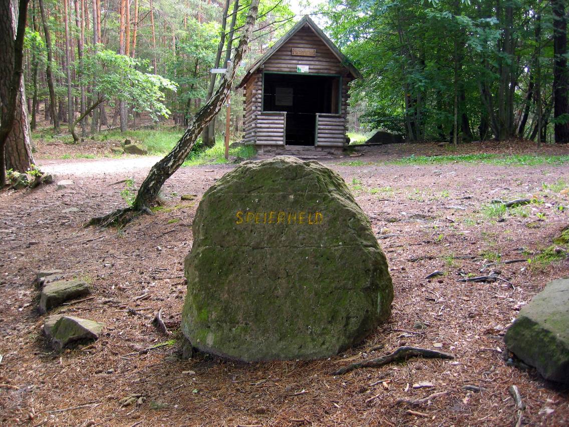
Ritterstein 248, known as the 'Speyerheld,' is a significant historical marker located in the Palatinate Forest (Pfälzerwald) west of Neustadt-Hambach. Situated along the popular hiking trail connecting the Nollensattel to the Hohe-Loog-Haus, this stone monument serves as a vital point of orientation for outdoor enthusiasts and history buffs alike. The Ritterstein marks the 'Speierheld,' a specific forest clearing and boundary line that historically defined the limits of the Speyerer Haagwald, a protected woodland area. The boundary line historically runs steeply down toward the Triftbrunnen, providing a glimpse into the medieval and early modern land management of the region. Visitors trekking through this area will find that it offers excellent trip ideas for those interested in the intersection of forestry history and regional geography. As you explore the Pfälzerwald, these stones act as silent witnesses to centuries of territorial delineations. Whether you are an experienced hiker or simply looking for unique local attractions to visit while exploring the Palatinate region, the Speyerheld provides a tangible connection to the past. The site is best enjoyed during the morning or early afternoon when the light filters through the canopy, highlighting the weathered inscriptions on the stone. Always ensure you check the local weather forecast before embarking on your hike, as forest conditions can change rapidly in this hilly terrain.
General information
Ritterstein 248, known as the 'Speyerheld,' is a significant historical marker located in the Palatinate Forest (Pfälzerwald) west of Neustadt-Hambach. Situated along the popular hiking trail connecting the Nollensattel to the Hohe-Loog-Haus, this stone monument serves as a vital point of orientation for outdoor enthusiasts and history buffs alike. The Ritterstein marks the 'Speierheld,' a specific forest clearing and boundary line that historically defined the limits of the Speyerer Haagwald, a protected woodland area. The boundary line historically runs steeply down toward the Triftbrunnen, providing a glimpse into the medieval and early modern land management of the region. Visitors trekking through this area will find that it offers excellent trip ideas for those interested in the intersection of forestry history and regional geography. As you explore the Pfälzerwald, these stones act as silent witnesses to centuries of territorial delineations. Whether you are an experienced hiker or simply looking for unique local attractions to visit while exploring the Palatinate region, the Speyerheld provides a tangible connection to the past. The site is best enjoyed during the morning or early afternoon when the light filters through the canopy, highlighting the weathered inscriptions on the stone. Always ensure you check the local weather forecast before embarking on your hike, as forest conditions can change rapidly in this hilly terrain.
Did you know
- Rittersteine are a series of over 300 sandstone markers in the Palatinate Forest that denote historical sites, viewpoints, or boundary lines.
- The 'Speyerer Haagwald' was a forest area historically owned or managed by the city of Speyer.
- The Pfälzerwald-Verein has been responsible for maintaining the hiking infrastructure and markers like the Ritterstein 248 for over a century.
History
Ritterstein 248 commemorates the 'Speierheld,' a historic forest boundary. In the context of the Holy Roman Empire, cities often held rights to distant forest tracts for timber and fuel. The Speyerer Haagwald was one such area, and the 'Speierheld' served as a prominent clearing that demarcated the transition of land ownership. These stone markers were typically placed by local forest authorities or the Pfälzerwald-Verein to preserve the cultural memory of these borders, which were once vital to the economic survival of the city of Speyer. They represent a transition from functional administrative markers to heritage sites that define the cultural landscape of the Palatinate today.
Cultural significance
The Ritterstein series is a cultural treasure of the Palatinate region, representing a unique form of regional heritage preservation. Unlike monuments dedicated to individuals, these stones honor the landscape itself and the historical relationship between human administration and nature. They are integral to the identity of the Palatinate Forest, turning a simple hike into an educational journey. The local hiking community holds these markers in high regard, often incorporating them into route planning to ensure that the history of the forest remains visible to modern generations.
Geography and landscape
The site is located in the heart of the Pfälzerwald, characterized by dense deciduous and coniferous forests and rugged sandstone formations. The terrain around Ritterstein 248 is hilly and typical of the Haardt mountain range. The path from the Nollensattel toward the Hohe-Loog-Haus involves moderate elevation changes, offering hikers sweeping views of the surrounding valleys. The specific location of the Speyerheld is marked by a steep descent toward the Triftbrunnen, a topographical feature that influenced the historical layout of the forest boundary lines in this area.
More facts
- Imported from OSM batch