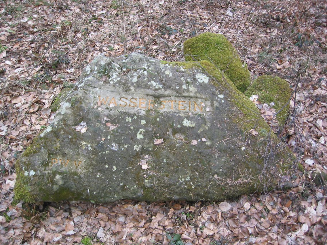
Ritterstein 155 "Wasserstein"
DE
- Location
- DE
- Category
- iconic bucket list
- Coordinates
- 49.4332967, 7.9555985
- Best time
- Morning or early afternoon
- Weather tip
- Check the local forecast before visiting.
Overview
Ritterstein 155, known as the 'Wasserstein,' is a significant historical marker located along the Hochstraße on the Schloßberg, southwest of Frankenstein, Germany. These Rittersteine (Knight Stones) are a series of sandstone markers scattered throughout the Palatinate Forest, serving as historical landmarks that commemorate specific sites, events, or geographical features. The Wasserstein itself is characterized by a ground-level, horizontal sandstone slab featuring a distinct bowl-shaped depression. Visitors often seek out these markers as part of larger hiking expeditions through the region, as they provide a tangible connection to the area's geological and cultural history. When planning your trip, consider these markers as essential points of interest for those exploring the Pfälzerwald. If you are looking for unique places to visit in the region, the Rittersteine offer a fascinating glimpse into local heritage. The site is best accessed during the morning or early afternoon to take full advantage of natural light for viewing the stone's features. As with any excursion into the Palatinate Forest, it is advisable to check the local weather forecast before setting out. Whether you are a dedicated hiker or a history enthusiast, the Wasserstein serves as a quiet, reflective stop on the trail, encouraging a deeper appreciation for the landscape and the historical markers that define it.
General information
Ritterstein 155, known as the 'Wasserstein,' is a significant historical marker located along the Hochstraße on the Schloßberg, southwest of Frankenstein, Germany. These Rittersteine (Knight Stones) are a series of sandstone markers scattered throughout the Palatinate Forest, serving as historical landmarks that commemorate specific sites, events, or geographical features. The Wasserstein itself is characterized by a ground-level, horizontal sandstone slab featuring a distinct bowl-shaped depression. Visitors often seek out these markers as part of larger hiking expeditions through the region, as they provide a tangible connection to the area's geological and cultural history. When planning your trip, consider these markers as essential points of interest for those exploring the Pfälzerwald. If you are looking for unique places to visit in the region, the Rittersteine offer a fascinating glimpse into local heritage. The site is best accessed during the morning or early afternoon to take full advantage of natural light for viewing the stone's features. As with any excursion into the Palatinate Forest, it is advisable to check the local weather forecast before setting out. Whether you are a dedicated hiker or a history enthusiast, the Wasserstein serves as a quiet, reflective stop on the trail, encouraging a deeper appreciation for the landscape and the historical markers that define it.
Did you know
- The 'Wasserstein' name refers to the bowl-shaped depression in the stone, which can naturally collect rainwater.
- Ritterstein 155 is part of a larger network of over 300 sandstone markers documented in the Palatinate Forest.
- These stones were originally established by the Pfälzerwald-Verein to preserve historical and geographical knowledge.
History
Rittersteine were established primarily during the late 19th and early 20th centuries by the Pfälzerwald-Verein. The project was initiated to mark locations of historical importance, folklore, or significant natural phenomena within the Palatinate Forest. Ritterstein 155, specifically identified as the 'Wasserstein,' belongs to this tradition of preserving regional identity through physical stone markers. While the exact date of the placement of stone 155 is not widely publicized in general records, the entire collection serves as a chronological archive of regional topography and local lore, having survived decades of exposure to the elements within the forest environment.
Cultural significance
The Rittersteine hold immense cultural value for the Pfälzerwald region, representing a collective effort to document and honor the landscape. They act as open-air archives, anchoring local stories and geographical facts to specific physical points. For hikers and locals, these stones are more than just landmarks; they are symbols of regional pride and historical continuity. By visiting the Wasserstein, one participates in a long-standing tradition of forest exploration and cultural preservation, connecting with the generations of hikers who have navigated these same paths and paused to study these markers.
Geography and landscape
The Wasserstein is situated on the Schloßberg, a prominent ridge southwest of the town of Frankenstein. The landscape is dominated by the dense, hilly terrain of the Palatinate Forest, characterized by its characteristic red sandstone formations and deep, forested valleys. The site is located directly on the Hochstraße, an ancient mountain road that traverses the region. The terrain is typical of the Pfälzerwald, offering rugged, scenic trails that wind through mixed woodland. The stone itself is embedded in the ground, reflecting the natural geology of the area where sandstone is the primary bedrock.
More facts
- Imported from OSM batch
Visitor links
Nearby attractions
- Ritterstein 159 "Drei Linden" 452 m
- Ritterstein 160 "Hochstraße" 456 m
- Ritterstein 156 "Biedenbacherwoog" 752 m
- Ritterstein 154 "Griesenfels" 1055 m
- Ritterstein 164 "Rattenfels" 1678 m
- Ritterstein 296 "Atlasfelsen" 1756 m
- Ritterstein 150 "Hohlog" 1763 m
- Ritterstein 163 "Franzosenwoog" 2205 m