Ritterstein 146 "Dammbrunnen"
DE
- Location
- DE
- Category
- iconic bucket list
- Coordinates
- 49.4062502, 7.8424528
- Best time
- Morning or early afternoon
- Weather tip
- Check the local forecast before visiting.
Overview
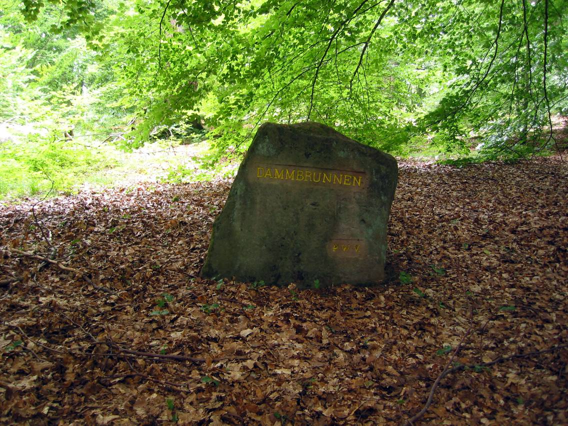
Ritterstein 146, known as the 'Dammbrunnen,' is a historical marker located northwest of the Horterkopf on the high plateau of the Dammberg in Germany. These stones are part of a series of over 300 monuments erected by the Pfälzerwald-Verein to commemorate significant historical, geographical, or cultural sites within the Palatine Forest. The Dammbrunnen site itself holds specific historical importance as the former location of a cattle watering hole, which included an artificially constructed mud wallow—a 'Suhle'—and a shelter for livestock. For hikers and history enthusiasts exploring the region, this site offers a glimpse into the agricultural past of the Palatine highlands. Visitors often include this marker as a point of interest when planning their hiking routes, as it serves as a quiet, reflective spot amidst the dense woodland. If you are looking for trip ideas or unique landmarks to discover while trekking through the Palatine Forest, the Ritterstein 146 provides a tangible connection to the traditional land management practices of the area. The site is best visited during the morning or early afternoon when light filters through the canopy, illuminating the weathered stone marker. As with many remote forest monuments, it is recommended to check the local weather forecast before setting out, as the plateau can be subject to rapid changes in conditions.
General information
Ritterstein 146, known as the 'Dammbrunnen,' is a historical marker located northwest of the Horterkopf on the high plateau of the Dammberg in Germany. These stones are part of a series of over 300 monuments erected by the Pfälzerwald-Verein to commemorate significant historical, geographical, or cultural sites within the Palatine Forest. The Dammbrunnen site itself holds specific historical importance as the former location of a cattle watering hole, which included an artificially constructed mud wallow—a 'Suhle'—and a shelter for livestock. For hikers and history enthusiasts exploring the region, this site offers a glimpse into the agricultural past of the Palatine highlands. Visitors often include this marker as a point of interest when planning their hiking routes, as it serves as a quiet, reflective spot amidst the dense woodland. If you are looking for trip ideas or unique landmarks to discover while trekking through the Palatine Forest, the Ritterstein 146 provides a tangible connection to the traditional land management practices of the area. The site is best visited during the morning or early afternoon when light filters through the canopy, illuminating the weathered stone marker. As with many remote forest monuments, it is recommended to check the local weather forecast before setting out, as the plateau can be subject to rapid changes in conditions.
Did you know
- The 'Ritterstein' markers are named after Karl Ritter von Staudt, who was a key figure in the Pfälzerwald-Verein.
- There are over 300 of these numbered sandstone monuments scattered throughout the Palatine Forest.
- The term 'Suhle' refers to a mud wallow, often used by wild boar, but here historically designated for livestock.
History
The Ritterstein markers were established by the Pfälzerwald-Verein beginning in the early 20th century to preserve the history of the Palatine Forest. Ritterstein 146, the Dammbrunnen, specifically marks a location that served as an essential agricultural infrastructure point. Historically, the plateau of the Dammberg was used for grazing, necessitating the creation of the cattle watering hole and the associated shelter. The stone marker serves as a permanent record of this human interaction with the landscape, ensuring that the site's original purpose is not forgotten as the forest reclaimed the area.
Cultural significance
Culturally, the Dammbrunnen is representative of the 'Heimat' movement in Germany, which emphasized the preservation of regional heritage and local history. By marking the site with a sandstone monument, the Pfälzerwald-Verein ensured that hikers and locals would recognize the site's importance beyond its current appearance as a quiet forest clearing. It serves as a testament to the rural, agrarian history of the region and the enduring dedication of local historical societies to cataloging the Palatinate's cultural landscape.
Geography and landscape
The Dammbrunnen is situated on the high plateau of the Dammberg, a characteristic feature of the Palatine Forest's topography. The terrain is characterized by dense mixed forest and weathered sandstone outcrops. Northwest of the Horterkopf, the landscape is relatively elevated, providing a distinct plateau environment that contrasts with the surrounding valleys. The area is typical of the Pfälzerwald, where narrow hiking trails wind through mature trees, leading to these historical markers that act as navigational anchors for those traversing the rugged highlands.
More facts
- Imported from OSM batch
Visitor links
Nearby attractions
- Ritterstein 140 "Stall" 843 m
- Ritterstein 153 "Hungerbrunnen" 1155 m
- Ritterstein 134 "Balkenbrunnen 160 Schr." 1675 m
- Ritterstein 264 "Scheidhütte Niliusburg" 1798 m
- Ritterstein 294 "Lauterspring" 2271 m
- Ritterstein 161 "R. F. Stiftswald" 3220 m
- Ritterstein 267 "Entersweiler Mühle" 3280 m
- Ritterstein 108 "Haidhaldbrunnen 220 Schr." 3766 m