Pelegrin Fortress
Haifa, IL

- Location
- Haifa, IL
- Category
- heritage historic sites
- Coordinates
- 32.7055852, 34.9337448
- Best time
- Morning or early afternoon
- Weather tip
- Check the local forecast before visiting.
Overview
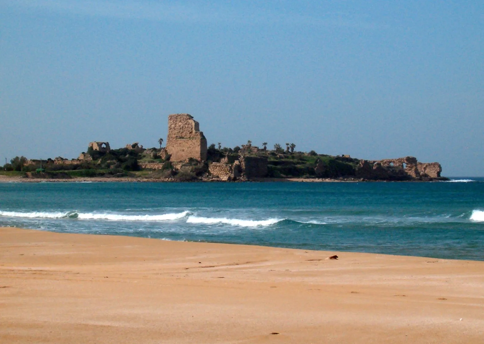
Pelegrin Fortress, also known as Château Pèlerin or Athlit Fortress, stands as one of the most significant Crusader-era fortifications in the Levant. Located along the Mediterranean coast just south of Haifa, this site represents a pinnacle of 13th-century military engineering. Visitors exploring the area often look for historical places to visit that showcase the intersection of medieval European architecture and Middle Eastern strategic needs. The fortress was the primary stronghold of the Knights Templar and remained the last Crusader outpost in the Holy Land until its abandonment in 1291. Today, the site is situated within a restricted military zone, meaning public access is generally limited to viewing the massive sea-facing walls and ruins from the nearby shoreline or designated viewpoints. Despite these restrictions, it remains a premier example of a concentric castle designed to withstand prolonged sieges. For those researching what to do in the area, the sight of the towering ruins against the backdrop of the Mediterranean offers a powerful visual connection to the region's turbulent medieval history. The fortress is characterized by its massive ashlar masonry and its strategic position on a promontory, which allowed it to be supplied by sea during land-based blockades.
General information
Pelegrin Fortress, also known as Château Pèlerin or Athlit Fortress, stands as one of the most significant Crusader-era fortifications in the Levant. Located along the Mediterranean coast just south of Haifa, this site represents a pinnacle of 13th-century military engineering. Visitors exploring the area often look for historical places to visit that showcase the intersection of medieval European architecture and Middle Eastern strategic needs. The fortress was the primary stronghold of the Knights Templar and remained the last Crusader outpost in the Holy Land until its abandonment in 1291. Today, the site is situated within a restricted military zone, meaning public access is generally limited to viewing the massive sea-facing walls and ruins from the nearby shoreline or designated viewpoints. Despite these restrictions, it remains a premier example of a concentric castle designed to withstand prolonged sieges. For those researching what to do in the area, the sight of the towering ruins against the backdrop of the Mediterranean offers a powerful visual connection to the region's turbulent medieval history. The fortress is characterized by its massive ashlar masonry and its strategic position on a promontory, which allowed it to be supplied by sea during land-based blockades.
Did you know
- Pelegrin Fortress was the only Crusader castle that never fell to a military siege; it was only vacated after the fall of Acre.
- The name 'Château Pèlerin' translates to 'Pilgrims' Castle,' as it was built with the help of pilgrims and served to protect them on their journey.
- The walls were built using massive stones, some weighing over 10 tons, to resist the impact of Mamluk siege engines.
History
Construction of the fortress began in 1218 during the Fifth Crusade. The Knights Templar, with the assistance of Teutonic Knights and visiting pilgrims, built it on the site of an earlier Phoenician settlement. Its design was revolutionary, featuring two massive concentric walls separated by a moat, which could be flooded with seawater. For decades, it served as the headquarters for the Templar Order in the region. Even after the catastrophic fall of Acre in 1291, the garrison at Pelegrin held out, eventually evacuating by sea in August of that year. Following the Crusader departure, the Mamluks partially dismantled the fortifications to prevent their reuse by future maritime invaders. In the 19th century, much of the remaining stone was quarried for construction projects in Acre and Haifa, though the core structure remains visible today.
Cultural significance
The Pelegrin Fortress is a symbol of the final chapter of the Crusader presence in the Levant. It represents the height of Templar power and their sophisticated understanding of maritime logistics and defensive architecture. In Israeli archeology, the site is recognized for its multi-layered history, including evidence of Phoenician and Persian maritime activity long before the Crusaders arrived. While currently serving as a base for the Israeli Navy's elite Shayetet 13 unit, the fortress remains a site of immense interest for historians and architects worldwide who study medieval fortification techniques and the history of the military orders.
Geography and landscape
The fortress is situated on a rocky promontory that juts out into the Mediterranean Sea, located approximately 14 kilometers south of Haifa. This natural peninsula provided a defensive advantage, surrounded by water on three sides. To the east, the site is bordered by the salt marshes and sandstone (kurkar) ridges of the Carmel coast. The surrounding landscape is characterized by coastal flora and sandy beaches, with the silhouette of Mount Carmel visible in the distance. The strategic positioning allowed the castle to control the coastal road while maintaining a deep-water port for naval support.
More facts
- Imported from OSM batch
Visitor links
Nearby attractions
- Atlit Yam Atlit - 596 m
- Le Destroit Eilat - 1183 m
- Tel Sahar Israeli North Coast - 2471 m
- Nahal Me'arot Nature Reserve Israel - 3982 m
- Janco Dada Museum Ein Hod - 4357 m
- Tabun cave Haifa District - 4900 m
- Zeevik Eilon Haifa - 5290 m
- Misliya Cave Haifa District - 5374 m