Nordwestlichster Punkt Deutschlands
DE
- Location
- DE
- Category
- viewpoints natural phenomena
- Coordinates
- 53.5973761, 6.6661327
- Best time
- Morning or early afternoon
- Weather tip
- Check the local forecast before visiting.
Overview
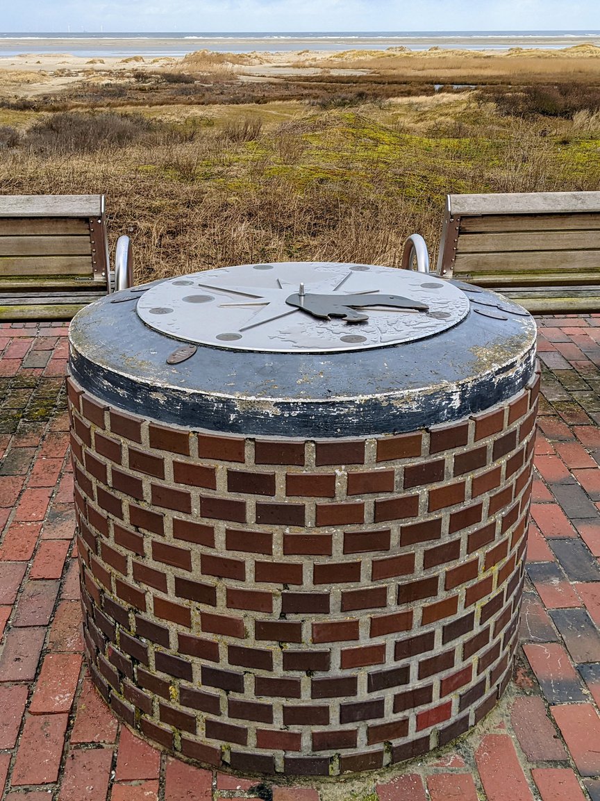
The Nordwestlichster Punkt Deutschlands, or the Northwesternmost Point of Germany, serves as a significant geographical marker for travelers interested in the physical boundaries of the nation. Located on the island of Borkum in the North Sea, this site marks the extreme northwestern coordinate of German territory. Visitors travel to this remote location to witness the meeting of land and sea at a unique geodetic milestone. The site is a popular destination for those seeking to explore the diverse landscapes of the East Frisian Islands and serves as a testament to the country's maritime borders. When planning your visit, it is advisable to consider the tidal conditions and local weather patterns, as the point is situated in an exposed coastal environment. As you explore what to do in the area, you will find that the island of Borkum offers extensive cycling paths and nature trails that lead toward this landmark. This site is ideal for photographers, geography enthusiasts, and hikers looking for unique trip ideas that take them to the literal edges of the country. Reaching the point requires a trek through the island’s dunes, providing an immersive experience of the North Sea coastal ecosystem. While the site itself is a simple geographical marker, the surrounding dunes and the vast horizon offer a profound sense of isolation and natural beauty, making it a rewarding objective for any visitor to the island.
General information
The Nordwestlichster Punkt Deutschlands, or the Northwesternmost Point of Germany, serves as a significant geographical marker for travelers interested in the physical boundaries of the nation. Located on the island of Borkum in the North Sea, this site marks the extreme northwestern coordinate of German territory. Visitors travel to this remote location to witness the meeting of land and sea at a unique geodetic milestone. The site is a popular destination for those seeking to explore the diverse landscapes of the East Frisian Islands and serves as a testament to the country's maritime borders. When planning your visit, it is advisable to consider the tidal conditions and local weather patterns, as the point is situated in an exposed coastal environment. As you explore what to do in the area, you will find that the island of Borkum offers extensive cycling paths and nature trails that lead toward this landmark. This site is ideal for photographers, geography enthusiasts, and hikers looking for unique trip ideas that take them to the literal edges of the country. Reaching the point requires a trek through the island’s dunes, providing an immersive experience of the North Sea coastal ecosystem. While the site itself is a simple geographical marker, the surrounding dunes and the vast horizon offer a profound sense of isolation and natural beauty, making it a rewarding objective for any visitor to the island.
Did you know
- The point is located on the island of Borkum within the Lower Saxon Wadden Sea National Park.
- The exact location is subject to minor shifts over time due to coastal erosion and the dynamic nature of the North Sea shoreline.
- It represents the furthest northwestern point of the German mainland territory, excluding offshore platforms.
History
The designation of the northwesternmost point of Germany is a result of modern geodetic surveying. Historically, the borders of Germany have shifted significantly due to political changes in the 19th and 20th centuries. However, the island of Borkum has remained a consistent part of the German coastal territory. The recognition of this specific point as a tourist landmark is a relatively recent development, driven by the public interest in 'extreme points' and geographical milestones within the Federal Republic of Germany. There is no major historical monument or structure marking this spot, as the focus remains on the natural geographical coordinate itself.
Cultural significance
The site holds significance primarily as a point of interest for geographers and nature enthusiasts. It represents the 'ends' of the country, a concept that holds a specific allure in German travel culture. Visiting such points is often seen as a badge of honor for hikers and explorers who wish to document their travels to the geographical extremes of the nation. Furthermore, the location within the Wadden Sea—a UNESCO World Heritage site—links the marker to the broader cultural and environmental importance of the North Sea coast, emphasizing the preservation of Germany's unique maritime natural heritage.
Geography and landscape
The landscape surrounding the Northwesternmost Point of Germany is defined by the shifting dunes and sandy beaches of the island of Borkum. As part of the East Frisian Islands, the area is characterized by a low-lying, wind-swept terrain that is heavily influenced by the North Sea's tides and currents. The vegetation is sparse, consisting mainly of salt-tolerant dune grasses and shrubs that stabilize the sandy soil. This coastal environment is highly dynamic; the proximity to the sea means the landscape is constantly reshaped by storm surges and wind erosion, creating a rugged, pristine setting that feels disconnected from the more densely populated mainland.
More facts
- Imported from OSM batch
Visitor links
Nearby attractions
- Kaiser-Wilhelm-Denkmal 33979 m
- Kap Norderney 34773 m