Loyston
US
- Location
- US
- Category
- heritage historic sites
- Coordinates
- 36.2650385, -83.9504355
- Best time
- Morning or early afternoon
- Weather tip
- Check the local forecast before visiting.
Overview
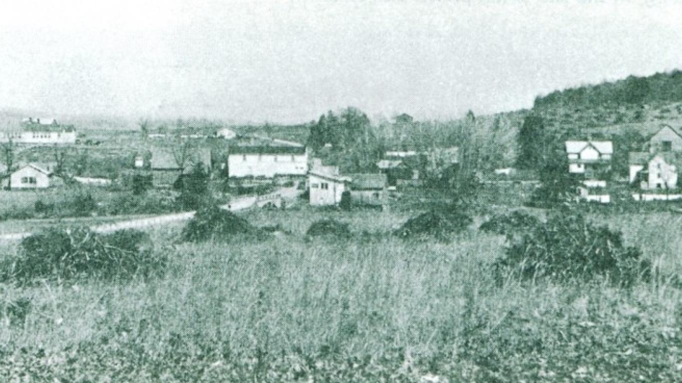
Loyston was a thriving rural community located in Union County, Tennessee, before it was permanently submerged in 1936. As part of the Tennessee Valley Authority’s (TVA) massive infrastructure project to construct the Norris Dam, the valley along the Clinch River was cleared and flooded to create Norris Lake. Today, the site serves as a poignant reminder of the human cost of industrial modernization in the American South. Visitors interested in historical exploration often seek out the area to understand the displacement of local populations and the environmental transformation of the region. While the original structures are now underwater, the surrounding area offers a serene landscape that provides excellent opportunities for those looking for unique trip ideas. The site is a popular destination for those interested in water-based recreation, such as boating and fishing, which allow visitors to traverse the waters directly above the former town center. As you plan your visit, consider the morning or early afternoon hours for the best visibility, and always check the local forecast before visiting to ensure a safe and pleasant experience. Exploring the remnants of the Loyston area provides a profound connection to the history of the Tennessee Valley and serves as a testament to the lives once lived in this now-submerged community.
General information
Loyston was a thriving rural community located in Union County, Tennessee, before it was permanently submerged in 1936. As part of the Tennessee Valley Authority’s (TVA) massive infrastructure project to construct the Norris Dam, the valley along the Clinch River was cleared and flooded to create Norris Lake. Today, the site serves as a poignant reminder of the human cost of industrial modernization in the American South. Visitors interested in historical exploration often seek out the area to understand the displacement of local populations and the environmental transformation of the region. While the original structures are now underwater, the surrounding area offers a serene landscape that provides excellent opportunities for those looking for unique trip ideas. The site is a popular destination for those interested in water-based recreation, such as boating and fishing, which allow visitors to traverse the waters directly above the former town center. As you plan your visit, consider the morning or early afternoon hours for the best visibility, and always check the local forecast before visiting to ensure a safe and pleasant experience. Exploring the remnants of the Loyston area provides a profound connection to the history of the Tennessee Valley and serves as a testament to the lives once lived in this now-submerged community.
Did you know
- Loyston was completely inundated in 1936 to facilitate the creation of Norris Lake.
- The flooding was a direct result of the Tennessee Valley Authority's first major project, the Norris Dam.
- Many former residents of Loyston relocated to higher ground, leaving behind a community that had existed since the early 19th century.
History
Loyston was settled in the early 1800s and functioned as a traditional Appalachian community, complete with a post office, schools, and local businesses. By the early 20th century, the Tennessee Valley was plagued by frequent flooding and economic instability. In 1933, the federal government established the Tennessee Valley Authority to manage the Clinch River. The construction of the Norris Dam required the acquisition of over 120,000 acres of land. Consequently, Loyston was identified as being within the flood zone. By 1936, the town was evacuated and demolished, and the valley was flooded, effectively erasing the physical footprint of the village from the landscape.
Cultural significance
The story of Loyston is a significant chapter in the history of the American New Deal era. It symbolizes the tension between national progress and local heritage. The displacement of the Loyston community serves as a case study in the sociological impacts of eminent domain and large-scale federal infrastructure projects. Culturally, the memory of the town is preserved through the oral histories of descendant families and regional historical societies, highlighting the resilience of Appalachian communities who faced the erasure of their homes for the sake of regional electrification and flood control.
Geography and landscape
The former site of Loyston is now situated beneath the deep, calm waters of the lower reaches of Norris Lake. The surrounding terrain is characterized by the rolling hills and limestone ridges typical of the Ridge-and-Valley Appalachians. Before the flooding, the village sat in a fertile river valley defined by the Clinch River. Today, the landscape is dominated by the expansive reservoir, which is surrounded by dense hardwood forests and protected public lands. The geography provides a stark contrast between the industrial utility of the dam and the natural beauty of the modern lake environment.
More facts
- Imported from OSM batch