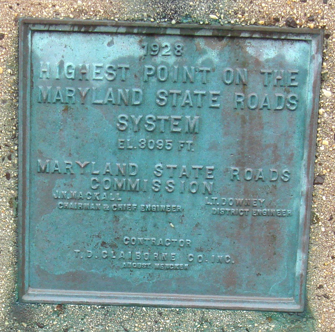
Highest Point on the Maryland State Roads System
US
- Location
- US
- Category
- heritage historic sites
- Coordinates
- 39.3014933, -79.4152363
- Best time
- Morning or early afternoon
- Weather tip
- Check the local forecast before visiting.
Overview
The Highest Point on the Maryland State Roads System is a notable geographic landmark situated within the Appalachian region of Western Maryland. Reaching an elevation of approximately 2,800 feet above sea level, this location marks the peak altitude attainable by a Maryland state-maintained roadway. Visitors seeking unique trip ideas often include this site in their itineraries when traversing the scenic corridors of Garrett County. The site offers a unique perspective on the state's rugged topography, providing motorists with a tangible sense of the significant elevation changes that characterize the transition from the Piedmont plateau to the Allegheny Mountains. As travelers navigate these winding mountain passes, they are treated to expansive views of the surrounding forest canopy and rolling ridges. This location serves as an essential stop for those interested in cartography, geography, or simply experiencing the diverse landscapes of the Mid-Atlantic. While there are few formal visitor amenities directly at the crest, the surrounding area is rich with local attractions, including state parks and historic mountain towns, making it a rewarding destination for a scenic drive. Before heading out, travelers should check the local forecast, as high-altitude weather conditions can shift rapidly compared to the lower elevations of the state. Whether you are a geography enthusiast or looking for interesting places to visit during a road trip, the highest point offers a brief but memorable connection to Maryland's physical landscape.
General information
The Highest Point on the Maryland State Roads System is a notable geographic landmark situated within the Appalachian region of Western Maryland. Reaching an elevation of approximately 2,800 feet above sea level, this location marks the peak altitude attainable by a Maryland state-maintained roadway. Visitors seeking unique trip ideas often include this site in their itineraries when traversing the scenic corridors of Garrett County. The site offers a unique perspective on the state's rugged topography, providing motorists with a tangible sense of the significant elevation changes that characterize the transition from the Piedmont plateau to the Allegheny Mountains. As travelers navigate these winding mountain passes, they are treated to expansive views of the surrounding forest canopy and rolling ridges. This location serves as an essential stop for those interested in cartography, geography, or simply experiencing the diverse landscapes of the Mid-Atlantic. While there are few formal visitor amenities directly at the crest, the surrounding area is rich with local attractions, including state parks and historic mountain towns, making it a rewarding destination for a scenic drive. Before heading out, travelers should check the local forecast, as high-altitude weather conditions can shift rapidly compared to the lower elevations of the state. Whether you are a geography enthusiast or looking for interesting places to visit during a road trip, the highest point offers a brief but memorable connection to Maryland's physical landscape.
Did you know
- This point reaches an elevation of approximately 2,800 feet above sea level.
- The location is situated within the Appalachian region, known for its complex geological history.
- Weather at this elevation can be significantly cooler than in the eastern parts of Maryland.
History
The history of the Maryland state road system is intrinsically linked to the development of early American infrastructure, particularly the need to traverse the Appalachian Mountains. As the state expanded westward, the construction of mountain roads became a feat of engineering, requiring the navigation of steep gradients and challenging terrain. This specific high point represents the culmination of decades of road surveying and construction efforts aimed at connecting the rural, mountainous western counties to the more populous coastal regions. While the road itself has seen various improvements and modern paving updates, its alignment through these high-altitude passes follows historical routes established to conquer the natural barriers of the Allegheny Plateau.
Cultural significance
The Highest Point on the Maryland State Roads System holds significance as a symbol of the state's diverse geography. For Marylanders, the transition from the coastal plains and the Chesapeake Bay to the high elevations of the west represents a dramatic shift in both landscape and culture. This site is frequently recognized by travelers as a gateway to the 'mountain lifestyle' of Western Maryland, characterized by its reliance on forestry, outdoor recreation, and a slower pace of life. It serves as a point of pride for local residents, highlighting the rugged, resilient spirit often associated with the Appalachian region of the state.
Geography and landscape
The landscape surrounding the Highest Point is defined by the Allegheny Mountains, a sub-range of the Appalachian Mountains. The terrain is characterized by dense deciduous forests, steep ridges, and deep valleys that create a dramatic, undulating horizon. At this elevation, the climate is distinct from the rest of the state, often experiencing earlier frosts and more significant snowfall during the winter months. The road winds through a corridor of mature hardwoods, providing a spectacular display of color during the autumn season. The geological composition of the area is primarily comprised of sedimentary rock, which has been weathered over millions of years to form the current mountain profile.
More facts
- Imported from OSM batch
Visitor links
Nearby attractions
- Cobbler Shop in 1859 11845 m