Camp Resolution of the Texan Santa Fe Expedition
US
- Location
- US
- Category
- heritage historic sites
- Coordinates
- 34.2994638, -101.0597575
- Best time
- Morning or early afternoon
- Weather tip
- Check the local forecast before visiting.
Overview
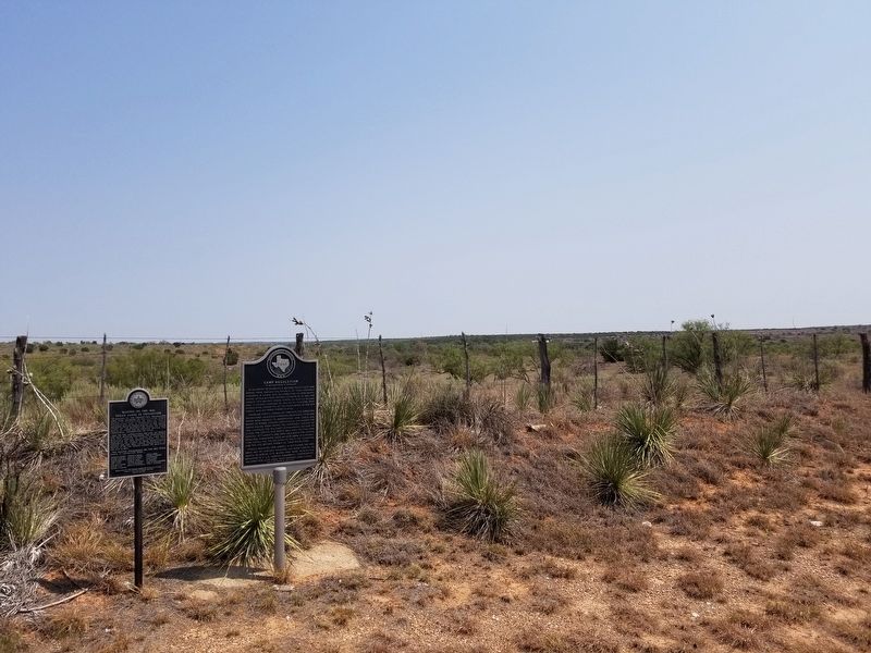
Camp Resolution serves as a significant historical landmark commemorating the ill-fated 1841 Texan Santa Fe Expedition. Situated between the confluence of Quitaque Creek and Los Lingos Creek, this site marks a critical point where the expedition members paused during their arduous journey from Austin toward Santa Fe. Today, visitors to this remote location can view two distinct historical markers placed side by side: one erected by the Texas Historical Commission and another dedicated by the Freemasons. For those researching regional history or seeking out off-the-beaten-path places to visit, this site offers a tangible connection to 19th-century frontier exploration. The location is best accessed during the morning or early afternoon hours to ensure visibility and comfortable exploration of the surrounding terrain. As this is an outdoor historical site, visitors are encouraged to check the local weather forecast before planning their trip to ensure safe conditions for viewing the markers. While the site is modest in scale, it remains a vital point of interest for historians and enthusiasts of Texas independence-era narratives looking for authentic trip ideas in the region. The markers stand as silent witnesses to the hardships endured by the expedition participants as they navigated the challenging landscape of the Texas Panhandle in search of a trade route to New Mexico.
General information
Camp Resolution serves as a significant historical landmark commemorating the ill-fated 1841 Texan Santa Fe Expedition. Situated between the confluence of Quitaque Creek and Los Lingos Creek, this site marks a critical point where the expedition members paused during their arduous journey from Austin toward Santa Fe. Today, visitors to this remote location can view two distinct historical markers placed side by side: one erected by the Texas Historical Commission and another dedicated by the Freemasons. For those researching regional history or seeking out off-the-beaten-path places to visit, this site offers a tangible connection to 19th-century frontier exploration. The location is best accessed during the morning or early afternoon hours to ensure visibility and comfortable exploration of the surrounding terrain. As this is an outdoor historical site, visitors are encouraged to check the local weather forecast before planning their trip to ensure safe conditions for viewing the markers. While the site is modest in scale, it remains a vital point of interest for historians and enthusiasts of Texas independence-era narratives looking for authentic trip ideas in the region. The markers stand as silent witnesses to the hardships endured by the expedition participants as they navigated the challenging landscape of the Texas Panhandle in search of a trade route to New Mexico.
Did you know
- The site features two separate historical markers standing side by side.
- The markers were provided by the Texas Historical Commission and the Freemasons, respectively.
- The camp was established during the 1841 Texan Santa Fe Expedition.
History
In 1841, the Republic of Texas launched the Texan Santa Fe Expedition with the goal of establishing trade routes and asserting claims over territory in present-day New Mexico. The expedition faced severe logistical challenges, including starvation, lack of water, and navigation errors. Camp Resolution serves as a physical record of the group’s progress. The expedition ultimately ended in the capture of its members by Mexican forces, making the sites along their route, such as this camp, significant historical touchpoints for understanding the geopolitical ambitions and failures of the young Republic of Texas.
Cultural significance
The site holds importance for its role in the collective memory of Texas history. The presence of a Freemason marker alongside a Texas Historical Commission marker highlights the intersection of civic history and fraternal organizations in preserving the state's heritage. It acts as a memorial to the men who took part in the expedition, many of whom faced significant suffering during the journey. By maintaining these markers, the local community ensures that the narrative of the 1841 expedition—a formative, albeit tragic, event in early Texas history—remains accessible to the public.
Geography and landscape
Camp Resolution is located in the rugged terrain of the Texas Panhandle, specifically nestled between Quitaque Creek and Los Lingos Creek. This area is characterized by semi-arid plains and creek beds that would have been vital for the expedition's survival in 1841. The landscape is largely rural and open, reflecting the challenging environment the expedition faced while crossing the Llano Estacado. The site is exposed to the elements, making it essential for modern visitors to be prepared for the specific weather conditions of this high-plains environment.
More facts
- Imported from OSM batch