Achtermannshöhe
DE
- Location
- DE
- Category
- viewpoints natural phenomena
- Coordinates
- 51.760875, 10.5689846
- Best time
- Morning or early afternoon
- Weather tip
- Check the local forecast before visiting.
Overview
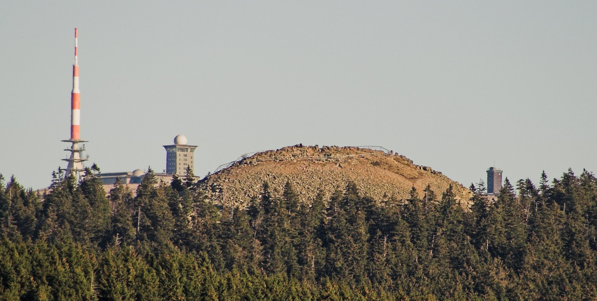
The Achtermannshöhe is a prominent mountain peak located within the Harz National Park in Germany, rising to an elevation of 925 meters above sea level. As the third-highest peak in the Lower Saxon Harz, it serves as a significant destination for hikers and nature enthusiasts looking for places to visit that offer expansive, panoramic views. The summit is characterized by its rugged, block-strewn landscape, typical of the high Harz granite formations, which creates a striking contrast against the surrounding dense spruce forests.
Visitors can expect a rewarding, albeit moderate, trekking experience. The ascent through the Harz landscape provides an immersive encounter with the region's unique montane ecology. Upon reaching the summit, the lack of tall vegetation allows for an unobstructed 360-degree vista, making it one of the most sought-after local attractions for photography and quiet contemplation. Due to the high altitude and exposed nature of the summit, weather conditions can change rapidly, often resulting in dramatic cloud formations or mist that envelop the peak. It is recommended to plan your visit for the morning or early afternoon to maximize visibility and to consult local meteorological reports before departure. Whether you are an avid mountaineer or simply seeking a serene escape into nature, the Achtermannshöhe provides a quintessential experience of the German highlands, standing as a testament to the geological history of the Harz mountain range.
General information
The Achtermannshöhe is a prominent mountain peak located within the Harz National Park in Germany, rising to an elevation of 925 meters above sea level. As the third-highest peak in the Lower Saxon Harz, it serves as a significant destination for hikers and nature enthusiasts looking for places to visit that offer expansive, panoramic views. The summit is characterized by its rugged, block-strewn landscape, typical of the high Harz granite formations, which creates a striking contrast against the surrounding dense spruce forests.
Visitors can expect a rewarding, albeit moderate, trekking experience. The ascent through the Harz landscape provides an immersive encounter with the region's unique montane ecology. Upon reaching the summit, the lack of tall vegetation allows for an unobstructed 360-degree vista, making it one of the most sought-after local attractions for photography and quiet contemplation. Due to the high altitude and exposed nature of the summit, weather conditions can change rapidly, often resulting in dramatic cloud formations or mist that envelop the peak. It is recommended to plan your visit for the morning or early afternoon to maximize visibility and to consult local meteorological reports before departure. Whether you are an avid mountaineer or simply seeking a serene escape into nature, the Achtermannshöhe provides a quintessential experience of the German highlands, standing as a testament to the geological history of the Harz mountain range.
Did you know
- The Achtermannshöhe reaches an elevation of 925 meters, making it the third-highest peak in the Lower Saxon Harz.
- The summit is composed of granite blocks, a geological feature known as a 'block field' or 'block sea'.
- The peak is part of the Harz National Park, which is a protected area for diverse flora and fauna.
History
The geological formation of the Achtermannshöhe dates back to the Variscan orogeny, which shaped the Harz mountains millions of years ago. The distinctive granite summit is a result of long-term weathering processes, where the softer rock surrounding the granite core eroded away, leaving the harder, block-filled peak exposed. While human activity in the Harz region has been historically linked to mining and forestry for centuries, the Achtermannshöhe itself has remained largely preserved as a natural landmark, serving as a navigational point for foresters and early travelers traversing the high-altitude trails of the Harz.
Cultural significance
The Achtermannshöhe holds a place in the regional identity of the Harz, often cited in local folklore and mountain literature as a site of mystery and natural beauty. It represents the rugged, untamed spirit of the Harz wilderness. In modern times, it serves as a symbol of the successful conservation efforts within the Harz National Park, drawing visitors who value sustainable tourism and the preservation of Germany’s natural heritage. It remains a focal point for hikers participating in the 'Harzer Wandernadel' hiking badge program, which encourages the exploration of significant peaks and landmarks throughout the mountain range.
Geography and landscape
The Achtermannshöhe is situated in the central part of the Harz mountains. Its landscape is defined by the transition from subalpine spruce forests to the exposed, rocky summit. The terrain is notably rugged, featuring a massive accumulation of granite boulders that require careful navigation. The peak is surrounded by a vast forest ecosystem that acts as a watershed for several small streams flowing into the valleys below. Its geographical isolation from other high peaks of similar stature provides it with a commanding presence, offering a unique perspective of the surrounding Harz plateaus.
More facts
- Imported from OSM batch
Visitor links
Nearby attractions
- Wurmberg 3433 m
- Goetheweg 3501 m
- Königsberg 3760 m
- Großer Winterberg 3852 m
- Brocken 5336 m
- Bruchberg 5448 m
- Scherstorklippen 6203 m
- Brockenkinder 6480 m